A practical guide to winter hiking in Gatlinburg TN, covering open trails, seasonal closures, safety tips, and the Smoky Mountain routes worth tackling in colder months.
Winter Smoky Mountain Hiking Trails: What's Open, Safe, and Worth It
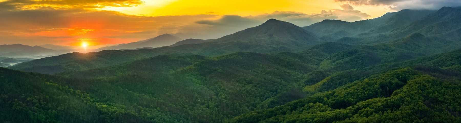
Winter doesn't end hiking season in the Smokies. It edits it.
As crowds thin and the forest sheds its leaves, Great Smoky Mountains National Park settles into a quieter, more deliberate rhythm. Trails remain open year-round, but access becomes selective as roads close and conditions sharpen.
It's important to read Smoky Mountain hiking trails well during winter, understand elevation, and choose the right routes that make sense for the season. Do that well, and you'll find some truly memorable Smoky Mountain hiking trails, touched by the most magical kind of winter stillness.
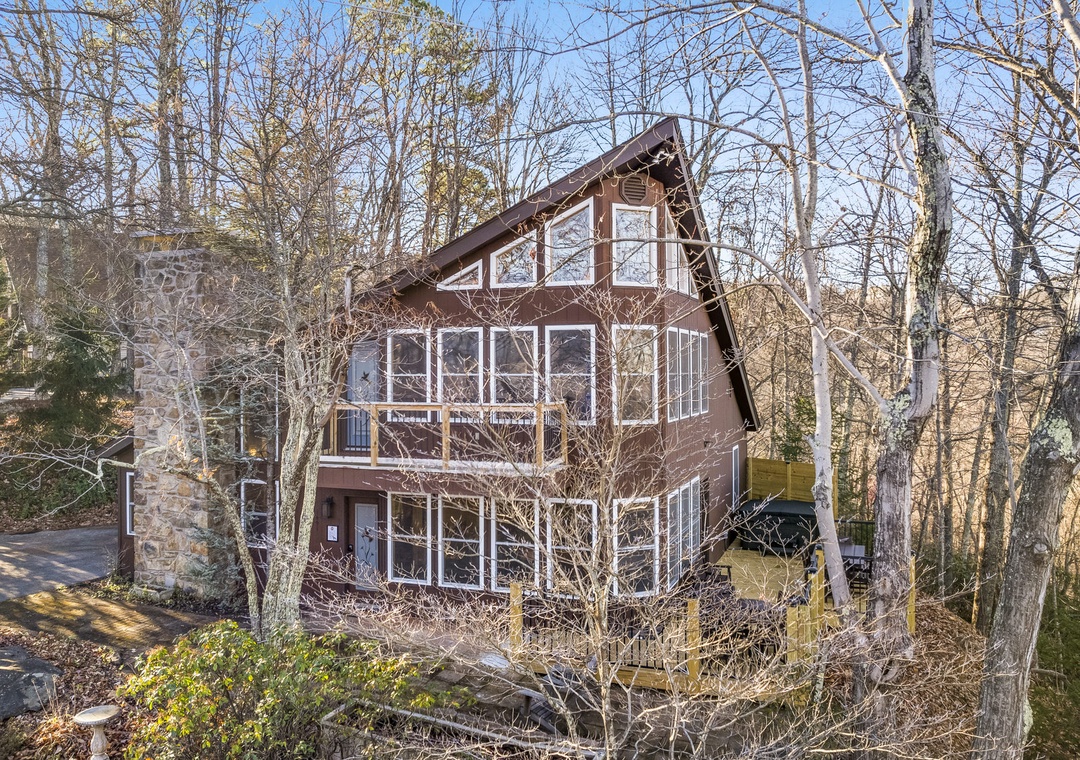
At Smoky Mountain Holiday, we offer a variety of cabins in Gatlinburg, Pigeon Forge, and Sevierville. With over 20 years of experience in the Smoky Mountains and a capable team of true locals, we like to think of ourselves as your go-to mountain experts.
Head over to our destination blog for great local insights, from the best rainy-day activities to the top eats in every town. We've got a treasure trove of hidden spots and insider tips waiting for you.
Today, we're bringing you a guide to winter hiking in Gatlinburg TN and Smoky Mountain hiking trails in winter.
Today, we're bringing you a guide to winter hiking in Gatlinburg TN and Smoky Mountain hiking trails in winter.
Winter Is One of the Best Times to Explore Smoky Mountain Hiking Trails
Ask locals when they prefer to hike, and many will point to winter.
With visitation at its lowest, even well-known Gatlinburg hiking trails feel calmer, especially midweek. Parking is easier, and trailheads are quieter.
Some of the key perks of hiking in winter include:
- Clearer views: Once the leaves fall, visibility improves dramatically. Cold air and passing winter fronts sweep away haze, opening long-range mountain views that summer rarely allows.
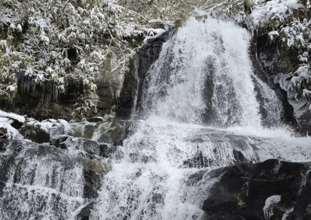
- Frozen waterfalls: Winter rains followed by freezes transform familiar cascades into ice-lined features that feel sculptural rather than seasonal.
- Fewer insects: Mosquitoes and other pests disappear entirely.
- Reduced wildlife activity: Bears retreat to lower activity levels, and venomous snakes are rarely encountered.
- Quieter forests: With fewer visitors, natural sounds carry further—flowing creeks, wind through bare branches, and winter birds become more noticeable.
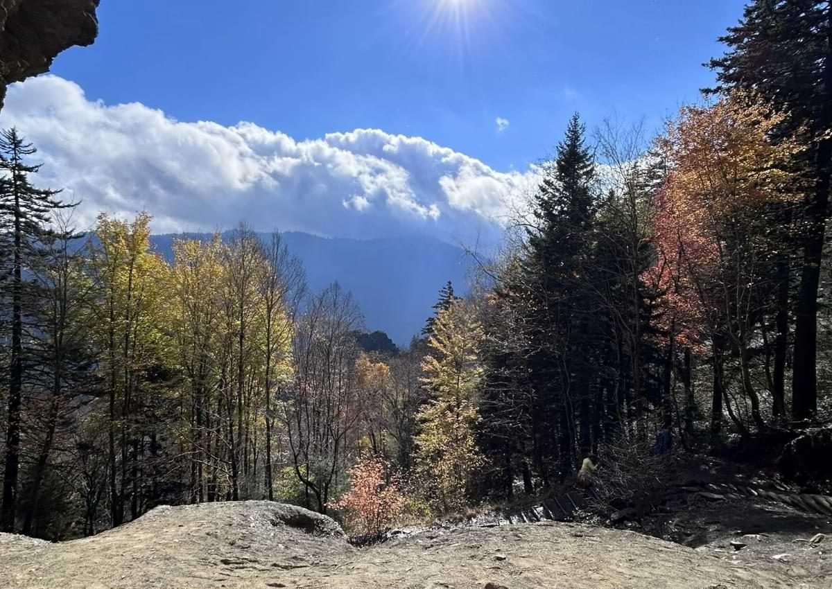
There's also a visual clarity to the Smokies in winter. Snow outlines ridges and hollows, while bare hardwoods reveal the true shape of the land. The park feels stripped back to its essentials.
The Trade-Offs Worth Taking Seriously
Conditions in the Smokies can shift quickly, and understanding the trade-offs is essential before heading out. Some of the main challenges to factor in include:
- Ice over snow: Ice is often more dangerous than snow, particularly on shaded trails, stone steps, and footbridges where traction disappears quickly.
- Rapid temperature changes: Temperatures drop roughly 3.5°F for every 1,000 feet of elevation gained, and wind at higher elevations can make conditions feel far colder than forecasts suggest.
- Limited daylight: Short winter days reduce how ambitious a hike should be. Routes that feel casual in summer often require stricter timing and firm turnaround points in winter.
- Seasonal road closures: Trails may be technically open, but closed access roads can make reaching the trailhead impractical or unsafe.
- Mixed precipitation: Snow is possible, but cold rain is more common at lower elevations. Overnight refreezing can turn wet ground into slick ice by morning.
Heads up! Approached with respect and planning, these challenges are manageable, but ignoring them is where winter hiking in the Smokies can quickly turn serious.
Best Winter Hiking in Gatlinburg TN
Alum Cave Trail
- Difficulty: Moderate to strenuous in winter
- Good for: Experienced hikers comfortable with ice and elevation gain
Alum Cave Trail is one of the most reliable winter hikes in the Smokies, but it demands preparation. Cold weather brings frequent ice, especially on stone steps and shaded sections near the bluffs. The trail climbs steadily through forest and along a creek before reaching Alum Cave Bluffs, where icicles and frozen seepage are common after prolonged cold.
At just over 4.4 miles round trip, the distance is manageable, but the 1,100-plus feet of elevation gain and persistent ice make this a serious winter outing. Inspiration Point offers open winter views, and strong hikers can continue toward Mount LeConte if conditions allow.
Why hike it in winter
- Ice formations along the bluffs
- Fewer crowds than warmer seasons
- Clear, leaf-off mountain views
Pro tips
- Start early to account for slower travel on ice
- Microspikes or crampons and trekking poles are strongly recommended
- Dress in layers; temperatures drop noticeably near the cave
⚠️ Alerts
- Ice can persist long after snowfall melts
- Parking fills quickly on clear winter weekends
- Conditions can change rapidly—set a firm turnaround time

Laurel Falls Trail
- Difficulty: Easy
- Good for: Families, beginners, short winter outings
Laurel Falls is one of the most approachable winter hikes in the Smokies. The paved trail and modest distance reduce risk compared to steeper routes, making it a solid choice during colder months. After hard freezes, the 80-foot waterfall often partially freezes, creating striking ice formations.
Because of its accessibility and proximity to Gatlinburg, Laurel Falls stays busy year-round. In winter, early mornings offer firmer footing and fewer people. Shaded sections and stone steps can still hold ice, so caution is necessary despite the easier terrain.
Why hike it in winter
- Frozen or partially frozen waterfall views
- Paved trail with minimal elevation gain
- One of the safer winter hiking options near Gatlinburg
Pro tips
- Start early for better footing and fewer crowds
- Waterproof boots and trekking poles help on icy patches
- Stay on the main trail; side routes can be slick
⚠️ Alerts
- Ice often lingers in shaded areas
- Crowds still build on weekends
- Short daylight makes late starts less forgiving
Gatlinburg Trail
- Difficulty: Easy
- Good for: Families, dog owners, low-risk winter walks
The Gatlinburg Trail is a dependable winter option when higher elevations are icy. This low-elevation, riverside route runs between Gatlinburg and Sugarlands Visitor Center and often remains accessible when other trails are not.
At 1.9 miles one way, the trail is mostly flat and well graded. Winter conditions are usually wet rather than snowy, with occasional icy patches in shaded sections. Historic chimneys and stone foundations line the route, adding interest without increasing difficulty. Pets and bicycles are permitted, which is uncommon in the park.
Why hike it in winter
- Lower elevation means fewer closures
- Consistent river views
- Easy terrain suited to short winter days
Pro tips
- Start early during holidays; traffic can slow access
- Waterproof footwear helps near the river
- Carry traction if temperatures drop below freezing
⚠️ Alerts
- Parking pass required for stops over 15 minutes
- Can be crowded on clear winter weekends
- Watch for ice on bridges and shaded stretches
Porters Creek Trail
- Difficulty: Moderate
- Good for: Solitude seekers, history-focused hikes, steady winter outings
Porters Creek Trail is a strong winter choice when higher elevations are inaccessible. Located in the Greenbrier area, it sits lower than many marquee Smoky Mountain hikes and often remains walkable through winter.
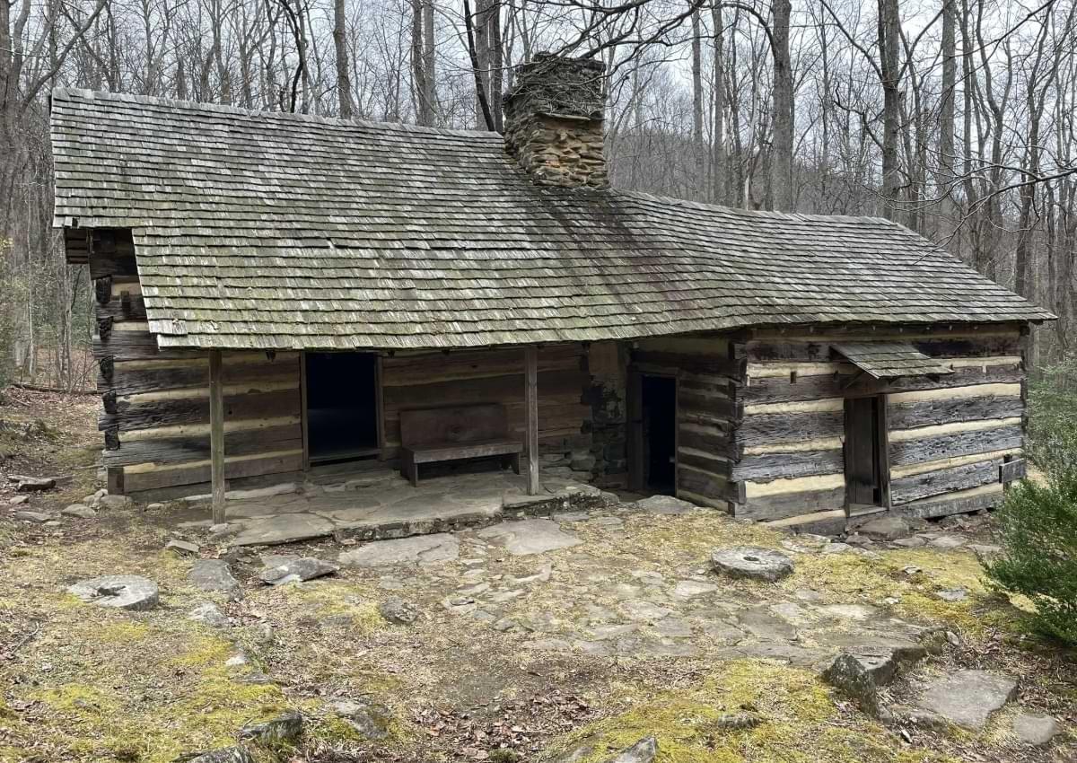
The route follows Porters Creek along a gravel road before narrowing into forest trail. Along the way, hikers pass stone walls, historic farm sites, and the Ownby Cemetery. Fern Branch Falls, about two miles in, frequently develops ice formations in winter. The trail is roughly four miles round trip with moderate elevation gain.
Why hike it in winter
- Quieter trail with fewer hikers
- Fern Branch Falls with seasonal ice
- Strong historic and cultural features
Pro tips
- Waterproof boots help with mud and wet ground
- Microspikes are useful on icy footbridges
- The waterfall makes a practical winter turnaround point
⚠️ Alerts
- Weather can shift quickly in Greenbrier
- Watch footing on roots, rocks, and bridges
Charlie's Bunion
- Difficulty: Strenuous
- Good for: Experienced winter hikers with proper gear
Charlie's Bunion is a high-elevation winter hike that should not be underestimated. Starting from Newfound Gap and following the Appalachian Trail, this route covers roughly eight miles round trip with steady elevation gain and long, exposed sections.
Snow, ice, and wind are common beyond the first mile. Temperatures along the ridge can be far colder than at the trailhead, and wind chill is a frequent factor. When conditions cooperate, the payoff is expansive, unobstructed winter views across the Smokies.
Why hike it in winter
- Panoramic views enhanced by leaf-off conditions
- Fewer hikers on a popular route
- True high-elevation winter experience
Pro tips
- Start early for parking and daylight
- Microspikes and trekking poles are strongly recommended
- Use wool or synthetic layers only—no cotton
⚠️ Alert
- This is a high-elevation hike and can be dangerous in winter and extreme weather. Ice, wind, and sudden cloud cover are common. Turn back if conditions deteriorate.
Andrews Bald
- Difficulty: Moderate (more strenuous in winter)
- Good for: Half-day hikes with open views
Andrews Bald offers open views and a quieter winter experience, but access and conditions matter. The hike is typically 3.6 miles round trip from the Forney Ridge Trailhead. In winter, stone steps, rocky footing, and ice near the start increase difficulty, followed by a steady uphill return.
The bald itself provides wide views toward Fontana Lake and the southern Smokies, framed by spruce–fir forest. Access depends on Newfound Gap Road being open; Clingmans Dome Road closes seasonally, which can complicate logistics.
Why hike it in winter
- Open views with fewer people
- Distinct high-elevation forest scenery
- Manageable distance for a winter day hike
Pro tips
- Start mid-morning to avoid crowds
- Microspikes help on icy steps
- Follow signed bypass routes on the return if needed
⚠️ Alert
- This is a high-elevation hike and can be dangerous in winter and extreme weather. Ice and sudden cold are common.
Safety, Gear, and Winter Awareness
Winter hiking requires preparation. Check road and weather conditions at both low and high elevations before starting. Plan shorter routes than in summer and set turnaround times based on daylight, not distance.
Ice is the main hazard, especially near water, on shaded sections, and on north-facing slopes. Traction devices, navigation tools, a headlamp, and extra layers are essential winter gear.
Before you head out, make sure to review these official safety guidelines for the Great Smoky Mountains.
Before you head out, make sure to review these official safety guidelines for the Great Smoky Mountains.
-9ED3EC81-231D-49D2-BD01E36696F27480.jpg)
Winter Weather in the Smokies
Elevation determines conditions. A mild day in Gatlinburg can mean snow, ice, and wind higher up. Lower elevations often see rain; ridges hold snow. Ice is the most persistent risk.
Expect daytime highs in the low 50s°F at lower elevations and mid-30s°F at higher elevations, with nighttime temperatures near freezing or below. Clear winter air often brings excellent visibility and long-range views.
Understanding Winter Access in the Smokies
In winter, roads matter as much as trails. Most hiking routes remain open year-round, but access depends entirely on which roads are passable that day.
- Newfound Gap Road (US-441) is the park's main artery and is usually open unless storms force temporary closures.
- Little River Road and the Cades Cove Loop Road are also often accessible, weather permitting.
- Many secondary roads, however—including Clingmans Dome Road, Roaring Fork Motor Nature Trail, Rich Mountain Road, Little Greenbrier Access Road, and Forge Creek/Parson Branch Roads—close for the season, cutting off access to otherwise popular hikes.
Heads up! Before heading out, always check official National Park Service updates for current road and trail conditions. A trail may be open, but if the access road is closed, reaching it safely may not be possible.
Make the Most of Your Stay in the Smoky Mountains with Smoky Mountain Holiday
While you're in Gatlinburg, Pigeon Forge, or Sevierville, make the most of your stay with Smoky Mountain Holiday's curated collection of cabins and vacation homes.
Whether you're looking for a convenient base near the park's best hiking trails or a comfortable retreat to unwind after a day of exploring the Smokies, our properties are designed to help you settle in and enjoy the region at your own pace.